The Hidden Privacy Costs of Aerial Drone Tracking Networks
How aviation safety mandates are building a surveillance web.
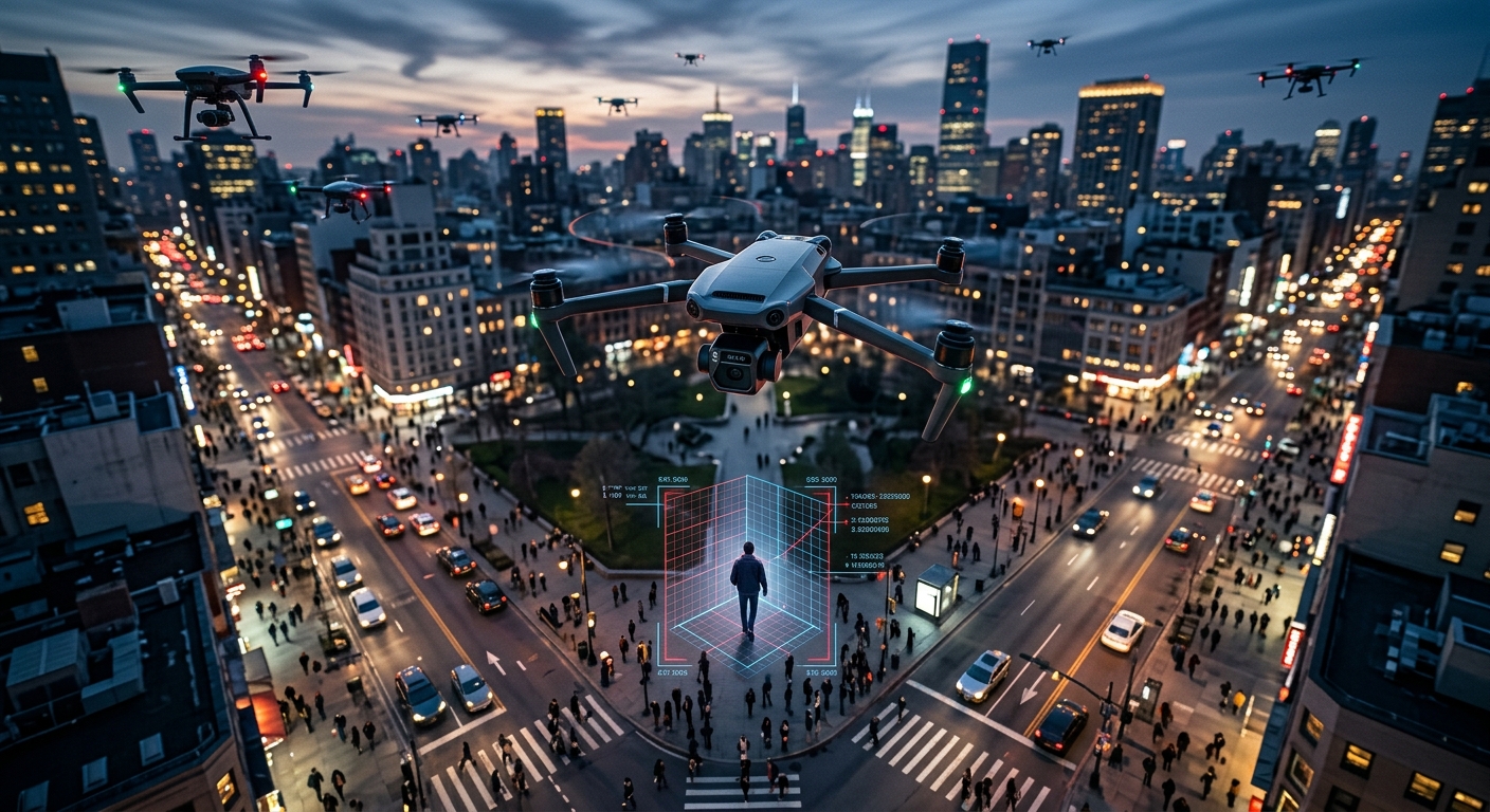
The integration of unmanned aerial vehicles (UAVs) into our daily lives has rapidly moved from the realm of speculative science fiction into highly visible, tangible reality. Today, the skies above our neighborhoods, parks, and city centers are increasingly populated by a incredibly diverse array of aircraft. Commercial logistics titans envision a near future where automated fleets seamlessly deliver retail packages, critical medical supplies, and groceries directly to our doorsteps. Concurrently, real estate agents taking overhead shots of properties, agricultural workers surveying crop health, recreational pilots, and independent journalists utilize these agile devices to capture breathtaking footage and cover significant news events from unprecedented vantage points.
However, this massive explosion of low-altitude aerial activity has necessitated a profound, sweeping shift in how national airspace is managed and monitored. To prevent catastrophic mid-air collisions and ensure robust homeland security, federal aviation authorities have mandated the implementation of a comprehensive digital tracking infrastructure. While championed by industry stakeholders as an absolutely vital safety protocol, this digital overhaul has inadvertently laid the foundation for a pervasive, highly intrusive aerial surveillance network.
At the center of this growing legal and ethical controversy is the regulatory requirement for continuous location broadcasting. This technological mandate forces both the flying aircraft and its ground-based human operator to transmit their exact physical coordinates in real-time. This dynamic intersection of unbridled commercial ambition, stringent aviation safety measures, and fundamental civil liberties raises urgent questions about the future of individual privacy in an increasingly connected, monitored world.
Understanding the Infrastructure: How Unmanned Aerial Tracking Works
To safely manage the complex, high-speed choreography of thousands of low-altitude flights, regulatory bodies have introduced a comprehensive operational framework often described as a “digital license plate” for the sky. Known technically in regulatory circles as Remote Identification (Remote ID), this expansive system compels the vast majority of consumer and commercial drones to emit a continuous, trackable digital heartbeat. Unlike traditional aviation radar, which passively bounces massive radio waves off a metallic object to determine its position in the sky, this new consumer standard requires the aircraft to actively broadcast its own precise telemetry data using localized radio frequency protocols, primarily utilizing Wi-Fi or Bluetooth technology.
The data packets transmitted through this new aviation infrastructure are incredibly detailed. They contain a unique, highly specific alphanumeric identifier tied directly to the federal registration of the aircraft. Furthermore, the broadcast includes the drone’s current altitude, velocity, and precise three-dimensional geographical coordinates. Crucially, and perhaps most controversially among civil rights advocates, the tracking system does not stop at monitoring the machine in the air. The broadcast mandate explicitly requires the transmission of the control station’s exact physical location. This means that the physical whereabouts of the human pilot, standing safely on the ground, are beamed out to the surrounding area in real-time alongside the drone’s aerial flight path.
Because this information is broadcast unencrypted, anyone with a compatible smartphone receiver or dedicated tracking hardware can intercept and read the data stream. By design, the system democratizes airspace awareness, theoretically allowing a concerned homeowner to use a mobile app to identify a drone hovering over their private property. Yet, this very transparency creates an unprecedented digital footprint. It inextricably links a physical person’s exact ground location to the fluid movements of an airborne camera, thereby laying bare the operational mechanics of every flight to both the general public and the state apparatus.
The Push for Commercial Logistics vs. Civil Liberties
The driving force behind this massive, unprecedented technological shift is not inherently rooted in a malicious desire for domestic surveillance, but rather in the pressing economic imperatives of modern logistics and aviation safety. Multinational retail corporations, food delivery startups, and massive shipping services have collectively invested billions of dollars into developing automated delivery networks. For these ambitious, highly lucrative corporate programs to scale safely and efficiently, the lower airspace cannot remain a chaotic, unregulated frontier. Drones must be able to digitally “see” and “talk” to one another to seamlessly avoid mid-air collisions, a concept widely known in aviation circles as an Unmanned Aircraft System Traffic Management (UTM) network.
However, accommodating this commercial revolution demands an incredibly heavy toll on personal anonymity and locational privacy. By structuring the national tracking system to primarily support the logistical needs of corporate fleets and federal safety mandates, policymakers have effectively mandated the creation of a ubiquitous surveillance web. Every hobbyist flying a small quadcopter in a local public park, every freelance photographer surveying a natural landscape, and every citizen journalist monitoring a civic protest is swept into the exact same digital dragnet designed to track commercial delivery vehicles.
Leading privacy advocates argue that this represents a fundamental, deeply concerning societal imbalance. While massive commercial entities stand to benefit immensely from the orderly, digitized airspace necessary to deploy lucrative drone delivery networks, everyday citizens are essentially forced to surrender their locational privacy to participate in aviation. The ongoing transformation of the lower atmosphere into an advanced “Internet of Things” ecosystem fundamentally alters the public’s traditional relationship with the sky, turning what was once a zone of relative freedom and anonymity into a highly regulated, thoroughly monitored digital grid where every movement is permanently logged and easily accessible.
Law Enforcement Access and the Risk of Mass Surveillance
Perhaps the most alarming and legally fraught dimension of this new tracking paradigm is exactly how the broadcast data can be heavily utilized by local, state, and federal law enforcement agencies. Because the required broadcast signals are completely unencrypted and readily available to any receiver within transmission range, police departments and federal agencies can easily harvest, aggregate, and store this immense volume of telemetry data without ever securing a judicial warrant. This capability represents a significant, highly controversial departure from traditional privacy protections, allowing the state to monitor the exact physical movements of citizens who are engaging in perfectly legal, everyday activities.
The constitutional implications of this tracking infrastructure are profound, currently drawing intense scrutiny from legal scholars who frequently point to recent landmark rulings regarding digital privacy. In the pivotal legal case Carpenter v. United States (2018), the United States Supreme Court definitively ruled that law enforcement must generally obtain a warrant to access an individual’s historical cell-site location information. The Court widely recognized that the continuous, systematic tracking of a person’s physical movements through their electronic digital devices reveals an intimately detailed, highly revealing chronicle of their life, personal associations, and daily habits. Privacy advocates forcefully argue that the continuous tracking of drone operators is intellectually and legally analogous; when an operator is tracked via their remote control station, the government is essentially tracking the individual’s physical movements across the earth.
Yet, current administrative frameworks for drone tracking critically lack the robust, necessary legal safeguards demanded by the spirit of the Carpenter decision. Currently, there are no universal legislative restrictions actively preventing law enforcement from proactively compiling massive databases of historical drone and pilot locations. This lack of regulation creates a chilling scenario where the state could retroactively map the exact locations of investigative journalists covering sensitive events, activists actively monitoring police activity, or ordinary citizens flying on their own private rural property. The glaring lack of a warrant requirement for accessing aggregated tracking databases effectively provides the government with a digital backdoor to mass surveillance, actively bypassing the standard Fourth Amendment protections traditionally afforded to the American public.
Comparing Traditional Aviation with Modern Drone Tracking
To fully grasp the unprecedented, highly unique nature of this technological surveillance, it is incredibly helpful to compare the standard tracking of traditional manned aircraft with the new digital protocols for unmanned aerial vehicles. While manned aviation has long been subject to stringent, highly organized monitoring, the context, physical realities, and privacy expectations differ dramatically from drone operations.
| Feature | Traditional Manned Aircraft | Consumer Unmanned Aircraft (Drones) |
|---|---|---|
| Pilot Location | Contained safely inside the flying aircraft, high above ground level. | Standing on the ground, often in highly accessible public spaces or residential private property. |
| Privacy Expectation | Extremely minimal; operating a massive, highly visible vehicle in strictly regulated commercial corridors. | Moderate to High; operating small, easily portable devices locally, often for private recreation or grassroots journalism. |
| Data Broadcast Content | System heavily broadcasts aircraft location, altitude, and ID. | Broadcasts both the aircraft’s location AND the ground-based human operator’s precise location. |
| Law Enforcement Surveillance | Flight paths are generally public, but physical pilot tracking is limited to the secured airport runway. | Authorities can precisely pinpoint the pilot’s physical, vulnerable location on the ground in real-time. |
As the table clearly illustrates, the critical, defining divergence lies in the direct tracking of the human operator. Traditional aviation radar systems strictly track the machine navigating in the sky; modern drone tracking systems simultaneously track both the machine and the individual standing unprotected on the earth.
Collateral Damage: Protecting the Drone Operator
Moving heavily beyond abstract constitutional arguments regarding state surveillance, the public broadcasting of a pilot’s exact physical location introduces immediate, highly tangible risks to physical safety. Drone operators frequently work entirely alone in remote geographical areas or, conversely, in highly populated, chaotic public spaces where they may easily attract unwanted attention. By mandated technological design, absolutely anyone with a smartphone can instantly locate the exact geographical coordinates of the person holding the expensive remote control equipment.
This forced digital transparency creates severe vulnerabilities to equipment theft, personal harassment, and physical assault. There have been numerous documented instances of irate, misinformed bystanders aggressively confronting drone pilots due to misunderstandings about where the aircraft is pointing or exactly what it is filming. By providing a highly accurate digital homing beacon straight to the pilot, the tracking mandate essentially arms hostile or unstable individuals with the exact technological tools needed to quickly locate and violently confront operators.
Furthermore, the strict requirement to universally broadcast location data exerts a severe chilling effect on constitutionally protected First Amendment activities. Independent photojournalists routinely rely on drones to safely document large-scale protests, hazardous industrial accidents, and sprawling environmental disasters. If their physical location is continuously broadcast to the very entities they are attempting to legitimately monitor—be it a massive corporation illegally polluting a river or a heavily armed police department engaging in controversial crowd control—their personal safety and their ability to report freely are critically compromised. The tragic loss of operational anonymity means that the technological tool once widely hailed for democratizing visual journalism could rapidly become an immense, life-threatening liability for those attempting to hold institutional power accountable.
Toward a Balanced Approach: Potential Privacy Safeguards
Stringent aviation safety and basic civil liberties do not have to be mutually exclusive concepts. It is entirely possible to intelligently construct a robust traffic management system that actively prevents mid-air collisions without subjugating the general public to continuous, unregulated state monitoring. Achieving this delicate balance requires a highly deliberate, privacy-first approach to both regulatory design and commercial drone routing operations.
First and foremost, access to the highly sensitive location data of the ground-based operator should be strictly and securely compartmentalized. While it may be absolutely necessary for the flying drone itself to broadcast its aerial position for immediate collision avoidance, the human pilot’s physical location should be digitally encrypted. This specific data should be accessible exclusively to verified aviation authorities, and only during an active, verifiable safety emergency, rather than being openly broadcast to the general public.
Second, the long-term retention of historical flight data must be severely restricted by law. If local police departments or sweeping federal agencies wish to access digital databases detailing exactly where a pilot has flown in the past, they must be legally required to obtain a judicial warrant based firmly on probable cause. This approach actively honors the vital legal precedents recently established by the courts to protect our modern digital location data.
Finally, federal policymakers must actively engage with established civil rights organizations to draft clear, binding legislative boundaries on exactly how drone telemetry can be legally used by the government. Without these statutory limitations, administrative agencies will inevitably continue to heavily prioritize logistical commercial efficiency and law enforcement convenience over the citizen’s fundamental constitutional right to privacy. The sky may indeed belong to everyone, but the digital footprints we inevitably leave while exploring it must securely remain our own.
Frequently Asked Questions (FAQs)
- What is a digital license plate for aerial vehicles?
It is a regulatory framework, heavily championed by federal aviation authorities and commonly referred to as Remote ID, that strictly requires unmanned aircraft to continuously broadcast their unique identifying information, current altitude and velocity, as well as the exact physical, real-time location of the ground-based operator. - Why do privacy advocates intensely worry about pilot location tracking?
Advocates are deeply concerned because the digital system broadcasts the human pilot’s exact geographical coordinates in real-time to absolutely anyone with a compatible receiver. This exposes civilian operators to potential physical harassment, enables law enforcement to digitally track individuals without a warrant, and can severely chill investigative journalistic activities by stripping away necessary operational anonymity. - Can the police freely access my complete drone flight history?
Because the required broadcast signals are completely unencrypted, local and federal law enforcement agencies can easily capture, aggregate, and store this telemetry data. Currently, there are incredibly weak legal safeguards preventing police from searching this historical data without a judicial warrant, raising severe, widely debated mass surveillance concerns. - How does this technology compare to modern cellphone location tracking?
In the landmark case Carpenter v. United States, the Supreme Court firmly ruled that law enforcement generally needs a legal warrant to access a citizen’s historical cell-site location information. Leading privacy experts and legal scholars argue that continuously tracking a drone pilot’s location is constitutionally similar and therefore should require the exact same stringent legal protections. - What legally happens if I disable my drone’s required tracking module?
Intentionally disabling mandated broadcast modules directly violates federal aviation rules and can rapidly result in significant civil penalties, massive financial fines, and the permanent revocation of your pilot certifications. - Are there any specific zones where tracking is not legally required?
Yes, aviation authorities typically designate highly specific geographic areas, officially known as recognized identification areas, where recreational hobbyists can legally fly without broadcasting digital tracking data. However, these zones are incredibly limited in number and strictly localized to designated club fields.
References
- Remote Identification of Drones — Federal Aviation Administration. 2025-03-19. https://www.faa.gov/uas/getting_started/remote_id
- Routing with Privacy for Drone Package Delivery Systems — MIT Media Lab. 2022-03-09. https://www.media.mit.edu/publications/routing-with-privacy-for-drone-package-delivery-systems/
- 16-402 Carpenter v. United States (06/22/2018) — Supreme Court of the United States. 2018-06-22. https://www.supremecourt.gov/opinions/17pdf/16-402_h315.pdf
Similar Articles






Read full bio of medha deb