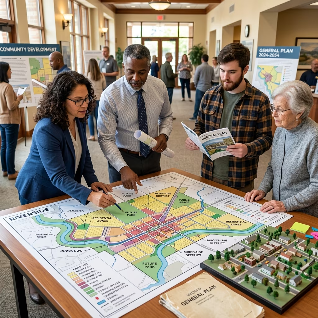
Every city or county uses a general plan (sometimes called a comprehensive plan) as its long-term blueprint for physical development, public investment, and community character. For homeowners and residents, this document quietly shapes daily life: where homes can be built, how you travel, which services you receive, and how neighborhoods evolve over time. This guide explains the major elements commonly found in a general plan and why they matter to you.
What Is a General Plan?
A general plan is an official policy document adopted by a local government that sets out long-range goals and policies for land use, infrastructure, housing, services, and environmental protection. Many states, such as California and Indiana, legally require communities to adopt such plans to guide future development and public investment.
- Time horizon: Typically covers 20–30 years of anticipated growth and change.
- Legal foundation: Zoning, subdivision approvals, and capital projects are expected to be consistent with the general plan.
- Community voice: Plans are usually developed with public input through meetings, workshops, and surveys.
Although terminology varies, most general plans are organized into distinct elements—topic-based chapters that address specific aspects of the community such as housing, transportation, and safety.
Core Elements You’re Likely to See
While the FindLaw article highlights ten common elements, many of them align with or expand on topics that states treat as required pieces of a general plan. Below are the major categories, explained in plain language and grouped into themes that matter most to residents.
1. Housing and Neighborhood Design
Housing and design policies determine what kinds of homes exist in your community, how neighborhoods feel, and whether there are options for different incomes and life stages.
Housing Policy
The housing element addresses how many homes are needed, where they should go, and how a community will meet demand, including affordable and special‑needs housing.
- Sets targets for new housing units, often based on projected population growth and regional housing needs.
- Identifies areas suitable for different housing types (single-family, apartments, mixed‑use).
- Promotes maintenance and rehabilitation of existing housing stock.
- May include incentives or requirements for affordable housing and accessibility.
For homeowners, housing policies affect property values, neighborhood density, and whether new development near you is mostly single-family homes, townhouses, or multifamily residences.
Urban Design and Community Character
The design-related portion of a general plan focuses on the look and feel of the built environment—architecture, streetscapes, public spaces, and how different types of development fit together.
- Guides building scale, setbacks, and overall visual character of neighborhoods.
- Addresses pedestrian‑friendly features such as sidewalks, shade, lighting, and street furniture.
- Encourages cohesive transitions between residential, commercial, and industrial areas.
When you see design guidelines for new subdivisions or requirements for attractive landscaping along major streets, they often stem from this portion of the general plan.
2. Land Use and Development Patterns
The land use element is the backbone of the general plan. It defines how land is allocated among residential, commercial, industrial, institutional, and open space uses.
Land Development and Zoning Framework
Land use policies translate into zoning regulations and development standards that shape where and how construction can occur.
- Maps future land use categories across the community (e.g., low‑density residential, mixed‑use corridors).
- Identifies growth areas and places where development should remain limited or rural.
- Coordinates with transportation and infrastructure so that new housing and businesses can be adequately served.
| Category | Common Uses | What It Means for Residents |
|---|---|---|
| Residential | Homes, apartments, condos | Influences density, housing options, and neighborhood character. |
| Commercial | Shops, offices, restaurants | Determines access to jobs, retail, and services near housing. |
| Industrial | Warehouses, manufacturing | Affects truck traffic, noise, and potential environmental impacts. |
| Institutional | Schools, hospitals, civic buildings | Shapes locations of essential community services. |
| Open Space | Parks, natural areas, greenbelts | Provides recreation, environmental benefits, and buffers between uses. |
Over time, land use decisions can transform agricultural land into neighborhoods or convert declining commercial strips into mixed‑use districts. Staying informed about land use proposals can help you anticipate changes around your home.
3. Transportation, Mobility, and Circulation
Transportation policies ensure that people and goods can move safely and efficiently through the community. Many plans separate transportation (systems and modes) from circulation (overall pattern of movement), but they are closely linked.
Transportation and Transit Systems
This portion of the plan describes the major corridors and modes available for travel.
- Identifies road hierarchies (local streets, collectors, arterials, highways).
- Maps public transit routes, stations, and potential expansions (bus, rail, paratransit).
- Addresses freight routes, ports, airports, and logistics hubs where applicable.
- Plans for bicycle lanes, multi‑use paths, and other active transportation infrastructure.
For residents, transportation policies affect commute times, availability of transit options, and the ease of walking or biking for daily errands.
Circulation and Traffic Management
The circulation aspect focuses on how the overall network functions to move people and vehicles safely and efficiently.
- Guides placement of intersections, traffic signals, and signage to manage flow and safety.
- Coordinates street connections so neighborhoods are accessible but not overwhelmed by cut‑through traffic.
- Considers emergency access routes for ambulance, fire, and evacuation.
Circulation planning can reduce congestion and improve safety, but it also influences whether your street remains quiet or becomes a major thoroughfare as development occurs.
4. Public Buildings, Facilities, and Services
A community’s general plan typically addresses not only where public structures are located but also how essential services are delivered. Some jurisdictions treat these as optional elements, but they are central to everyday life.
Public Buildings and Community Facilities
This topic covers the physical locations of key public institutions.
- Police and fire stations, which influence emergency response times.
- Schools, libraries, and civic centers that serve as hubs of education and civic life.
- Hospitals and clinics that support community health.
- Recreation facilities such as community centers, sports complexes, and cultural venues.
The plan aims to align facility locations with population growth so that new neighborhoods are adequately served.
Utilities and Public Services
Public services policies address the systems that make modern living possible: water, sewer, power, waste management, and emergency preparedness.
- Water distribution, wastewater treatment, and stormwater management.
- Solid waste and recycling facilities and collection networks.
- Energy infrastructure, including electricity and sometimes natural gas networks.
- Emergency warning, evacuation planning, and resilience measures for disasters.
A well‑planned utility and services network reduces service disruptions, protects water quality, and supports orderly growth rather than haphazard extensions of pipes and wires.
5. Recreation, Open Space, and Environmental Stewardship
Recreation and environmental elements ensure that communities do more than just build roads and houses; they also protect natural resources and offer places for leisure, exercise, and mental well‑being.
Parks, Trails, and Recreational Opportunities
The recreation component focuses on how residents access open space and leisure activities.
- Plans for neighborhood parks and community parks that serve different scales of users.
- Designates greenways and trails that link parks, schools, and commercial areas.
- Addresses equitable distribution of recreation facilities across neighborhoods.
Access to parks and recreational facilities has been linked to improved physical and mental health, reduced stress, and stronger social connections.
Historical and Cultural Preservation
Many communities include policies to protect historical sites, cultural landscapes, and significant natural features.
- Identifies buildings, districts, or landmarks with historical or cultural importance.
- Sets criteria for preservation, adaptive reuse, or compatible infill development.
- May require review before demolishing or altering recognized heritage resources.
Preservation efforts help maintain a community’s unique identity and can support tourism and local pride.
Environmental Protection and Resource Conservation
The environmental and conservation components address the protection of air, water, soil, habitats, and broader ecological systems.
- Designates conservation areas, floodplains, or environmentally sensitive lands where development is limited.
- Sets policies to reduce pollution exposure and improve air quality.
- Encourages sustainable practices such as energy efficiency, green infrastructure, and climate adaptation.
In some states, environmental justice is now a required topic, ensuring that environmental burdens and benefits are distributed more fairly among communities.
6. Redevelopment and Long-Term Change
Not all planning is about new growth; some elements focus on how older or underused areas can be revitalized. Redevelopment policies guide investment in aging infrastructure and neighborhoods.
- Identifies areas of disinvestment or blight where targeted improvements are needed.
- Promotes infill development, adaptive reuse, and mixed‑use projects to make better use of existing infrastructure.
- Coordinates redevelopment with housing, transportation, and economic development goals.
Carefully planned redevelopment can increase property values and amenities, but it should also consider affordability and displacement risks so existing residents can benefit from improvements.
How These Elements Work Together
Each element of the general plan is intended to be consistent with the others, meaning that housing decisions must align with land use, transportation, safety, and environmental goals.
- Integrated policy: New housing near transit corridors may be encouraged to reduce car dependence and pollution.
- Growth management: Land use maps, transportation capacity, and public services planning work together to avoid overburdening infrastructure.
- Resilience and safety: Environmental and safety elements inform where development should avoid high‑risk areas such as floodplains or wildfire zones.
For residents, understanding these interactions helps explain why certain projects are encouraged in some locations and restricted in others.
Practical Tips for Homeowners and Residents
You do not need to be a planner to benefit from your community’s general plan. A few practical steps can help you engage with long‑term decisions.
- Locate the plan: Most municipalities host the general plan on their official website under planning or development services.
- Scan key maps: Focus on land use, transportation, and open space maps to see how your area is designated.
- Check future changes: Look for proposed growth areas, corridor plans, or redevelopment zones that might affect your property.
- Participate in updates: Attend public meetings or workshops when the plan is being updated; laws often encourage broad community input.
- Ask staff: Planning departments typically provide contact information for questions about how plan policies apply to specific sites.
Frequently Asked Questions (FAQs)
Is a general plan the same as zoning?
No. The general plan is a long-range policy document that sets overall goals and land use patterns, while zoning ordinances are regulatory tools that implement those policies at the parcel level. Zoning must generally be consistent with the general plan, but the two documents operate at different levels of detail.
How often is a general plan updated?
Update schedules vary by state and community. Some elements, such as housing, may be legally required to be updated on set cycles (for example, every 8 years in parts of California), while other elements are updated as needed. Communities often undertake comprehensive updates every 10–20 years, with interim amendments in between.
Can residents influence what goes into the plan?
Yes. Public participation is a core part of general plan preparation and updates. Residents can attend meetings, submit comments, serve on advisory committees, or work with neighborhood groups to shape priorities on housing, transportation, environmental justice, and more.
Why should I, as a homeowner, care about the general plan?
The general plan influences future development near your property, the availability of parks and services, traffic patterns, and even local tax and infrastructure decisions. Understanding it helps you anticipate change, advocate for improvements, and evaluate how proposals align with community goals.
Where can I find more information?
Your local planning or development services department typically provides access to the current general plan and related documents, including maps, environmental reports, and implementation programs. Many also offer summaries or interactive tools to help residents explore the plan.
References
- Learn More – PlanSanRamon — City of San Ramon. 2023-05-01. https://plansanramon.com/learnmore
- Chapter 1: The General Plan System — Los Angeles Department of City Planning. 2020-01-15. https://planning.lacity.gov/cwd/framwk/chapters/01/01.htm
- General Plan — OC Development Services, County of Orange. 2022-09-10. https://pwds.oc.gov/service-areas/oc-development-services/planning-development/codes-and-regulations/general-plan
- General Plan — Santa Clara County Department of Planning and Development. 2021-11-30. https://plandev.santaclaracounty.gov/codes-and-policies/general-plan
- Creating a General Plan that Builds Disaster Resilience — Enterprise Community Partners. 2020-06-01. https://www.enterprisecommunity.org/learning-center/resources/creating-general-plan-builds-disaster-resilience
- The Comprehensive Plan — Purdue Extension (Publication ID-234-W). 2014-01-01. https://extension.purdue.edu/cdext/thematic-areas/community-planning/collaborative-projects/_docs/_pubdocs/id-234-w.pdf