Digital Trails: How Police Track Crime Across State Lines
An in-depth look at cell data, plate scanners and GPS tools that let modern law enforcement follow suspects across state borders.
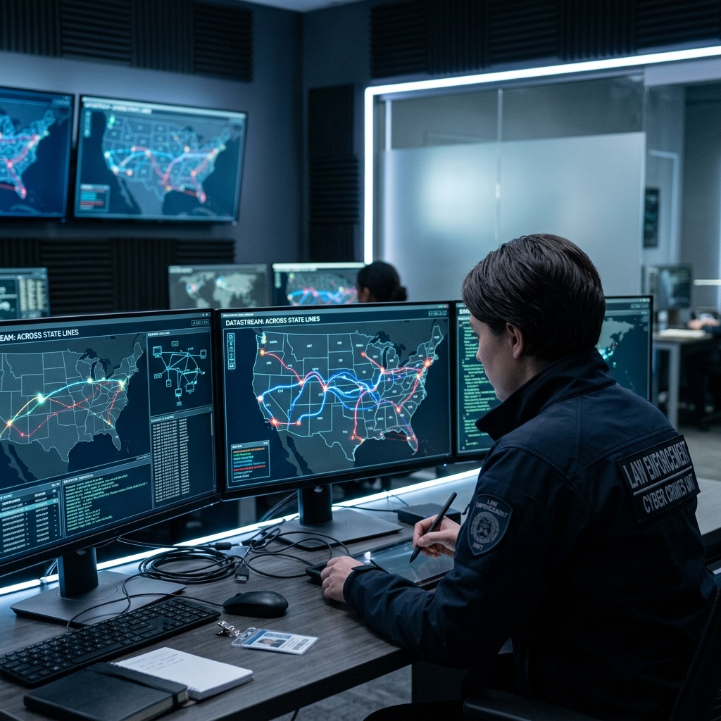
Law enforcement agencies increasingly rely on digital location data and automated surveillance tools to investigate crimes that cross city, county, and state borders. Cell tower records, license plate scanners, GPS trackers, and real-time analytics have become central pillars of interstate investigations, allowing police to follow suspects far beyond their home jurisdiction while raising complex questions about privacy and constitutional limits.
From Local Patrols to Data-Driven Interstate Investigations
For much of the twentieth century, police trying to track suspects across state lines depended on human surveillance, phone calls between agencies, and paper records. Today, technology allows investigators to:
- Capture and analyze location data from phones, vehicles, and roadside sensors in near real time.
- Share digital evidence quickly between agencies and prosecutors in different states.
- Map patterns of movement to connect related crimes, such as organized theft rings or trafficking routes.
These capabilities are especially important for crimes that inherently involve travel, such as drug trafficking, human trafficking, organized retail theft, multi-state burglary rings, and fugitive apprehension.
Cell Tower and Phone Data: Following the Signal
One of the most powerful tools in interstate investigations is the ability to use cellular network data to approximate a person’s location. Cell phones constantly communicate with nearby towers, leaving behind a digital trail that can be reconstructed after the fact or, in some situations, accessed in near real time.
What Cell Data Can Reveal
Depending on the legal authority and the cooperation of phone carriers, investigators may be able to obtain:
- Call detail records showing the time and general location of calls, texts, and data sessions.
- Historical cell-site location information indicating which towers a phone connected to over days or months.
- Real-time location pings to follow a suspect’s phone as it moves, sometimes used during fugitive hunts or kidnapping investigations.
By plotting this information on a map, police can reconstruct travel routes, identify common meeting points, and verify whether a suspect was near the scene of a crime when it occurred.
Legal Limits on Cell Phone Tracking
U.S. courts recognize that detailed phone location data implicates significant privacy interests. The Supreme Court has held that long-term historical cell-site records generally require a warrant, reflecting the idea that continuous location tracking reveals intimate details of a person’s life.
Key principles that typically shape cell phone tracking include:
- Warrant requirement for extended or detailed historical location data, supported by probable cause.
- Judicial oversight through court orders, similar to wiretap or pen register authorizations.
- Targeted use focusing on specific phones or accounts rather than broad, dragnet collection.
Because phone records can cross state lines as easily as the people who use them, interstate investigations often involve coordination between multiple jurisdictions and careful attention to differing state privacy statutes.
Automatic License Plate Recognition: Reading the Roads
Another core technology for tracking interstate crime is automatic license plate recognition (ALPR)
How License Plate Readers Work
ALPR systems can be installed on:
- Fixed roadside poles, overpasses, or traffic lights.
- Mobile platforms, such as patrol cars or specialized enforcement vehicles.
- Private locations that partner with law enforcement, such as parking facilities.
As vehicles pass by, the cameras capture images and the software extracts plate numbers, timestamps, and GPS coordinates. This information is then stored in databases that can be queried by investigators.
Typical Uses in Interstate Crime Investigations
License plate data becomes especially valuable when crime crosses jurisdictional boundaries. Investigators may use ALPR systems to:
- Identify vehicles associated with suspects and track their movement across highways and state borders.
- Locate stolen cars travelling on major routes used for illicit transport.
- Corroborate witness accounts by verifying whether a particular vehicle was near a crime scene at a specific time.
- Detect patterns suggesting trafficking or organized theft, such as repeated trips between known hotspots.
| Feature | Investigative Benefit |
|---|---|
| High-volume scanning | Captures thousands of plates quickly, helping locate a single car in heavy traffic. |
| Time and location stamps | Allows reconstruction of vehicle routes across jurisdictions. |
| Database queries | Enables searches for specific plates or patterns (e.g., frequent visits to known crime hubs). |
Privacy and Oversight Concerns
Because ALPR systems can record data on millions of ordinary drivers, they raise important questions about data retention and access. Analysts note that:
- Long-term retention of plate data can reveal detailed patterns of travel and association.
- Some states have adopted statutes limiting how long plate data can be stored and who can access it.
- Policies may restrict sharing plate data with non-law enforcement entities or require logging all queries for audit purposes.
These rules aim to balance the investigative value of plate readers against the risk of mass surveillance.
GPS Tracking: Precision Tools for Moving Targets
While cell and ALPR data often provide indirect location information, GPS trackers can supply precise, continuous coordinates for specific vehicles or individuals. Police may use GPS technology in several ways.
Types of GPS Use in Law Enforcement
- Fleet management: Patrol cars and specialty units are often equipped with GPS devices so dispatchers can see where units are and assign them efficiently.
- Covert tracking: Investigators may attach small GPS devices to suspect vehicles in operations sometimes referred to as “tag-and-track” or “slap-and-track.”
- Offender monitoring: Parolees or individuals under certain court orders may be required to wear GPS-enabled ankle monitors.
How Covert Vehicle Tracking Works
In a typical covert operation, officers place a discrete GPS device on a suspect vehicle—often in a wheel well or under the bumper—without alerting the driver. The device then transmits location data back to a monitoring system via cellular or radio networks, allowing investigators to follow the vehicle remotely.
Benefits of this approach include:
- Reducing the need for physical tailing, which can be dangerous or resource-intensive.
- Providing detailed movement logs that can be used as evidence if the case goes to court.
- Supporting multi-day or multi-week operations without constant surveillance teams.
Constitutional Constraints on GPS Tracking
Attaching a GPS device to a suspect’s vehicle is considered a search under the Fourth Amendment in the United States, generally requiring a warrant based on probable cause. Courts and legislatures emphasize:
- Probable cause that the vehicle is connected to criminal activity.
- Clear time limits on how long the device may remain in place.
- Documentation and supervision to ensure compliance with legal standards.
Interstate operations must also account for differences in state laws governing tracking devices, adding another layer of complexity for multi-jurisdiction investigations.
Smart Surveillance and Real-Time Analytics
Beyond individual tools, modern law enforcement increasingly relies on integrated surveillance systems and data analytics platforms. These systems can combine information from cameras, license plate readers, sensor networks, and databases to present a unified picture of activity in a region.
Common Surveillance Strategies
Experts describe several widely used strategies in contemporary policing:
- Fixed cameras for monitoring high-crime or high-traffic areas, often networked to central command centers.
- Hidden cameras in locations relevant to specific investigations, such as utility poles near a suspect’s home.
- Mobile surveillance from vehicles and, increasingly, drones.
- Thermal imaging systems for low-light or obstructed environments.
These resources can be critical when suspects cross state lines, as they allow agencies to hand off surveillance responsibilities while maintaining continuous awareness of a target’s movements.
Artificial Intelligence and Pattern Detection
Artificial intelligence (AI) and machine learning tools are increasingly used to analyze large volumes of data generated by modern surveillance systems. In the context of interstate crime, AI can:
- Identify patterns of travel consistent with particular criminal enterprises.
- Flag suspicious combinations of events, such as stolen vehicle plates appearing near known trafficking corridors.
- Support predictive analytics that help agencies allocate resources to areas at higher risk of interstate crime activity.
While these tools promise efficiency and improved detection, they also raise concerns about algorithmic bias, transparency, and the risk of over-reliance on automated decision-making.
Balancing Public Safety with Civil Liberties
Interstate tracking technologies operate at the intersection of public safety and privacy. On one hand, these tools help law enforcement disrupt dangerous activities that move across borders, including trafficking, violent crime, and large-scale fraud. On the other hand, the same tools can, if misused or poorly regulated, enable broad surveillance of people who are not suspected of any wrongdoing.
Key Safeguards and Best Practices
Legal scholars and practitioners emphasize several safeguards to maintain an appropriate balance:
- Clear policies specifying when location tracking tools may be used, what approvals are required, and how data should be handled.
- Limited data retention for non-evidentiary records, especially mass-collected data from license plate readers and cameras.
- Training for officers, analysts, and supervisors on legal standards, privacy risks, and ethical decision-making.
- Audits and oversight mechanisms to review how tools are used and to detect potential misuse.
Where implemented effectively, these practices help ensure that technological advances in interstate policing are aligned with constitutional protections and community expectations.
Frequently Asked Questions
Do police need a warrant to access cell tower records?
For detailed or long-term historical cell-site location information, courts generally require police to obtain a warrant supported by probable cause. Shorter, less detailed records may involve different standards, but agencies often pursue judicial orders to avoid legal challenges.
Can license plate readers track every car on the highway?
Technically, plate readers on busy routes can capture data from a very large number of vehicles. However, policy and law typically limit how that information can be stored, searched, and shared. Investigators usually focus queries on specific plates linked to open cases rather than monitoring all drivers.
Is GPS tracking of a vehicle always legal if the driver is a suspect?
No. Attaching a GPS device to a vehicle is considered a search and typically requires a warrant in U.S. jurisdictions. Agencies must show probable cause, adhere to time limits, and comply with state-specific rules governing tracking devices.
How do different states coordinate when a suspect crosses borders?
Agencies rely on formal mutual aid agreements, task forces, and shared databases to coordinate surveillance and evidence collection. When technologies like plate readers or cell data are involved, investigators must respect each state’s legal standards while building cases that can withstand scrutiny in court.
What role does artificial intelligence play in tracking interstate crime?
AI primarily helps analyze large datasets—such as plate reader logs, camera footage, and GPS records—to identify patterns and connections that humans might miss. It does not replace human judgment but can guide investigators toward promising leads or highlight unusual activity for further review.
References
- Technology in Law Enforcement: Modern Tools and Practices — American Public University System. 2023-05-01. https://www.apu.apus.edu/area-of-study/security-and-global-studies/resources/technology-in-law-enforcement/
- How Police Use GPS Tracking — BrickHouse Security. 2022-09-15. https://www.brickhousesecurity.com/blog/how-police-use-gps-tracking
- GPS Tracking for Law Enforcement: Tools for Surveillance and Investigations — TrackingTheWorld. 2023-03-20. https://trackingtheworld.com/blog/gps-tracking-for-law-enforcement/
- 5 Key Tech Trends Powering Modern Law Enforcement — Hubstream Software. 2022-11-10. https://www.hubstreamsoftware.com/resources/key-trend-modern-law-feature/
- Surveillance Tips: 6 Strategies for Law Enforcement Success — Critical Technology Solutions. 2021-08-05. https://www.criticalts.com/articles/law-enforcement-surveillance-strategies/
- Surveillance: How Many Ways Can Investigators Watch You? — Ralls & Wille Law. 2020-02-14. https://rallswillelaw.com/blog/surveillance-how-many-ways-can-investigators-watch-you/
Similar Articles






Read full bio of Sneha Tete